
Garmin GPSMAP 79s
4.2Editor score
Rugged floating design
Water-resistant IPX6 rating
High-resolution color display
Extended battery life
Navigating the open water requires reliable technology to ensure safety and efficiency on every journey. A high-quality Marine GPS Unit provides precise positioning, detailed mapping, and essential data to keep your vessel on course regardless of conditions. Whether you are fishing, cruising, or racing, the right device enhances situational awareness and simplifies route planning for all boaters.
We have carefully analyzed the leading models available this year to compile this comprehensive list. Our evaluation focuses on display quality, connectivity options, sonar integration, and overall ease of use. By comparing real-world performance and user feedback, we highlight the strengths and weaknesses of each unit to help you make an informed decision for your specific boating needs.
Each selection in this guide showcases a unique blend of features tailored to different budgets and vessel sizes. From rugged handhelds to advanced multifunction displays, you will find options that suit various marine environments. Please note that prices and availability may change frequently, so we recommend verifying current details before making your final purchase decision.
4.2Editor score

4.4Editor score

5.0Editor score
As an Amazon Associate we earn from qualifying purchases.
The following table provides a side-by-side overview of the top Marine GPS Units available this year. Each entry highlights key specifications to help you quickly identify which device aligns best with your navigation and fishing requirements.

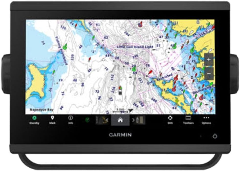


The Simrad GO Chartplotter stands out as a versatile choice for modern boaters needing robust navigation tools. With a strong user rating, it offers a balance of functionality and ease of use that appeals to both novices and experienced captains. Its ability to integrate sonar and radar into one unit makes it a central hub for boat electronics.
We may earn a commission when you buy through this link, at no additional cost to you.
This unit includes a C-MAP Discover card with full-featured Vector Charts and custom depth shading. The HDI transducer support ensures clear CHIRP sonar and DownScan Imaging to identify fish and bottom structure accurately. Built-in GPS and Wi-Fi allow you to mirror the display to a smartphone for remote access to charts and radar data.
While the price is higher than basic models, the included features justify the investment for serious boaters. The NMEA 2000 connectivity offers extensive integration options for other marine devices on board. Some users may need to purchase additional accessories to unlock full functionality depending on their boat configuration.
We recommend this unit for sportboats and center consoles where space is limited but performance is critical. It provides reliable navigation and fishing insights in a single package. If you need a dependable system that grows with your vessel, this chartplotter is an excellent investment for safety and efficiency.
The included C-MAP Discover card provides high-resolution bathymetric contours and ultra-wide coverage across the US and Canada for confident route planning.
Built-in Wi-Fi and NMEA 2000 support allow you to connect smartphones, tablets, and other marine electronics for a unified boating experience.
We may earn a commission when you buy through this link, at no additional cost to you.
The Garmin ECHOMAP UHD2 94sv is a top contender for boaters seeking a bright, easy-to-use chartplotter with essential features included. Its high rating reflects user satisfaction with the display clarity and intuitive interface. This model simplifies navigation and fishing with a comprehensive package that reduces the need for extra purchases.
We may earn a commission when you buy through this link, at no additional cost to you.
Included in the box is the GT56-TM transducer which supports traditional, ClearVü, and SideVü scanning sonars. The built-in Navionics+ coastal charts provide detailed data for US waters. Wi-Fi connectivity lets you share waypoints and sonar images with other ECHOMAP UHD2 units without cables.
While the touchscreen is bright, it may become less responsive in heavy rain or wet conditions. Users focused on inland lakes might find the coastal charts less relevant for their specific needs. However, the integration with Force trolling motors adds significant value for anglers using electric propulsion.
We suggest this unit for center consoles and small cruisers needing a balance of performance and cost. It is ideal for those who want reliable navigation and fishfinding without building a complex network. If you prioritize ease of use and quality display, this chartplotter delivers excellent value.
The included GT56 transducer enables detailed views of fish and structure using traditional, ClearVü, and SideVü scanning technologies.
Wirelessly connect to Force trolling motors to control speed and navigate waypoints directly from the chartplotter for streamlined fishing trips.
We may earn a commission when you buy through this link, at no additional cost to you.
The Garmin GPSMAP 943xsv represents the pinnacle of marine navigation technology for those who demand the best. Its high rating among users underscores its reliability and advanced capabilities for serious boaters. This unit is designed to provide exceptional clarity and detail in challenging marine environments.
We may earn a commission when you buy through this link, at no additional cost to you.
It features ultra high-definition scanning sonar and support for Panoptix sonar systems. The improved display optics ensure sharp images and readable text even in bright sunlight. Pre-loaded mapping saves time and ensures you have essential data available from the moment you power on.
The cost is significant, which may be a barrier for casual users or smaller boats. The system is complex and may require professional installation to fully utilize its potential. However, the level of control and detail it offers is unmatched in the current market.
We recommend this model for offshore cruisers and professional vessels where navigation precision is non-negotiable. If you need advanced sonar views and a display that performs under pressure, this is the ideal choice. It justifies its price through superior build quality and cutting-edge technology.
Improved optics on the display deliver exceptional clarity and contrast for safe navigation in all lighting conditions.
Support for Panoptix systems allows you to see fish and structure in real time from multiple angles with stunning detail.
We may earn a commission when you buy through this link, at no additional cost to you.
The Garmin GPSMAP 1243xsv is engineered for boaters who need to manage extensive marine systems from a central display. It offers robust connectivity options that allow you to integrate multiple devices and engines seamlessly. This model is designed for larger vessels where system coordination is key.
We may earn a commission when you buy through this link, at no additional cost to you.
It supports expanding engine compatibility and connecting third-party devices via OneHelm digital switching. The preloaded Navionics+ charts ensure you have detailed coastal data ready for use. Remote control features let you monitor and adjust settings from various points on the boat.
Since this is a specialized unit, ratings may be sparse as it targets specific professional or advanced users. Setup can be complex and might benefit from professional assistance to ensure all devices communicate correctly. The investment in such a system pays off through operational efficiency and safety.
We suggest this unit for large cruisers or vessels with multiple engines and electronics. If you need a central hub to manage your boat systems remotely, this model excels. It is best suited for users who understand network integration and want maximum control over their marine environment.
Connect third-party devices via OneHelm digital switching to simplify controls and improve system efficiency on larger boats.
Preloaded Navionics+ charts provide detailed coverage of waters worldwide so you can navigate confidently without extra purchases.
We may earn a commission when you buy through this link, at no additional cost to you.
The Garmin GPSMAP 79sc is a rugged handheld option designed for outdoor and marine adventures where portability matters. It is preloaded with BlueChart g3 coastal charts to help you navigate safely near shorelines. Its floating design ensures it stays accessible even if dropped overboard.
We may earn a commission when you buy through this link, at no additional cost to you.
It supports multiple satellite constellations for reliable tracking worldwide. The built-in 3-axis compass shows heading even when standing still. Barometric altimeter tracks pressure changes to pinpoint altitude and weather shifts. Battery life offers up to 20 hours in GPS mode for long trips.
Some users report lower ratings compared to other handhelds due to screen durability concerns. The interface might feel less intuitive for first-time GPS users. However, for small boats or as a backup navigation tool, its features provide solid value and peace of mind.
We recommend this device for kayak anglers, sailors, and those needing a reliable backup. It is lightweight and tough enough for active environments. If you need a handheld that floats and includes charts without extra costs, this is a practical choice for coastal navigation.
Support for GPS, GLONASS, Galileo, and Beidou ensures consistent positioning even in challenging environments with limited sky view.
Barometric altimeter tracks pressure changes to alert you to weather shifts and pinpoint your precise altitude for safe boating.
We may earn a commission when you buy through this link, at no additional cost to you.
The Garmin GPSMAP 79s is a straightforward handheld GPS built for reliability and durability. It features a worldwide basemap to help you get a general sense of your location anywhere on the globe. The unit is rugged and floats, making it safe for marine environments.
We may earn a commission when you buy through this link, at no additional cost to you.
It supports multiple satellite constellations for reliable tracking around the world. The built-in 3-axis compass helps you keep direction even when moving slowly. Battery life provides up to 20 hours in GPS mode for extended adventures. High-resolution display and scratch-resistant glass protect against wear.
This model does not include detailed marine charts, so it is best used with an app or separate maps. It lacks some advanced features found in pricier models. However, for basic navigation, it offers excellent value and durability for its price point.
We suggest this unit for hikers, kayakers, and small boat owners needing basic positioning. It is a great backup for situations where primary systems fail. If you need a simple, tough device that floats and works everywhere, this handheld meets your needs well.
Includes a worldwide basemap to ensure you can navigate basic routes in remote or international waters without extra data cards.
IPX6 water resistance and a floating design ensure the unit stays functional and accessible even after accidental drops into water.
We may earn a commission when you buy through this link, at no additional cost to you.
The Garmin GPSMAP 1022xSV offers a spacious 10-inch display for detailed navigation and mapping tasks. It is a combo unit that handles chartplotting efficiently with a high user rating reflecting satisfaction. This model is ideal for those who want a large screen but plan to add their own sonar later.
We may earn a commission when you buy through this link, at no additional cost to you.
It includes a basic basemap to start your navigation journey immediately. The interface is designed to be intuitive for easy route creation and tracking. Since no transducer is included, you can choose a sonar that fits your specific fishing needs and budget.
Buying separately may increase the total cost compared to bundled packages. You will need to ensure compatibility with any added transducers or accessories. However, the flexibility to customize your system makes this a smart choice for long-term boating setups.
We recommend this unit for cruisers who want a large display without committing to specific sonar technology. It is a solid foundation for a marine network. If you prefer flexibility in hardware choices and a large screen for charts, this model is a reliable option.
A 10-inch display provides ample room to view detailed charts and map data without straining your eyes during long trips.
Since no transducer is included, you can select sonar equipment that matches your budget and specific fishing style requirements.
We may earn a commission when you buy through this link, at no additional cost to you.
The Garmin GPS 76 is a classic handheld navigator designed for essential tracking and navigation tasks. Its high rating indicates durability and performance that users trust for outdoor activities. This device provides basic positioning features without overwhelming complexity for straightforward use.
We may earn a commission when you buy through this link, at no additional cost to you.
It is WAAS enabled to improve accuracy by tracking up to 12 satellites. The trip computer shows current and average speed along with trip distance. Battery life offers up to 16 hours from two AA batteries for a full day of use. It is compact and easy to carry.
This model uses older technology compared to modern touchscreen devices. The display is basic and might lack detail for advanced charting needs. However, for simple waypoint tracking and basic navigation, it remains a reliable and cost-effective tool.
We suggest this unit for beginners or as a secondary backup device. It works well in situations where you need reliable positioning without advanced features. If you prioritize simplicity and proven reliability, this GPS unit is a practical choice for your gear.
WAAS enabled receiver ensures precise location tracking by continuously accessing up to 12 satellites for better position data.
Built-in trip computer displays current speed, average speed, and distance traveled to help you monitor your journey effectively.
We may earn a commission when you buy through this link, at no additional cost to you.
The Garmin GPSMAP 1223xsv earns a perfect rating for its outstanding performance as a GPS and fishfinder combo. The 12-inch IPS display ensures bright images visible even in direct sunlight for safe navigation. It offers traditional CHIRP and scanning sonars to detail fish and structure clearly.
We may earn a commission when you buy through this link, at no additional cost to you.
It includes a worldwide basemap covering coastal areas, lakes, and rivers. J1939 connectivity allows connection to engines while NMEA 2000 networking links to VHF radios and autopilots. Wi-Fi and Bluetooth enable smartphone access for updates and data sharing. Compatible with optional BlueChart g3 Vision charts.
The cost is high which reflects its advanced features and premium build. The size requires a dedicated mounting space on larger vessels. For serious anglers or cruisers needing top-tier performance, these trade-offs are worth the investment. It is a complete solution for navigation and fishing.
We recommend this unit for boats with space for a large display needing all-in-one features. It is perfect for those who want the best possible sonar and map data. If you value clarity and connectivity, this fishfinder delivers unmatched quality and reliability.
The 12-inch IPS display delivers vibrant colors and wide viewing angles so maps are easy to read in any light condition.
Built-in Wi-Fi and Bluetooth let you sync charts, updates, and waypoints with smartphones or tablets for seamless data management.
We may earn a commission when you buy through this link, at no additional cost to you.
The Garmin GPSMAP 743 is a dedicated chartplotter offering perfect navigation without integrated sonar. It comes with a 7-inch screen and Navionics+ charts for detailed US coastal mapping. This model earns a 5.0 rating for reliability and ease of use by boaters focusing on navigation.
We may earn a commission when you buy through this link, at no additional cost to you.
Pre-loaded mapping saves you from searching for initial data. Improved display optics provide clear views even in bright conditions. It is a streamlined device for those who need accurate positioning without fishfinding features. Setup is simple and ready to use immediately upon installation.
The lack of sonar means you need an external device for fish targets. The screen is fixed at 7 inches which may be small for some cruisers. However, for basic navigation tasks, its clarity and included charts make it a strong choice for safety and efficiency.
We suggest this unit for captains prioritizing route accuracy over fishfinding. It is ideal for commercial vessels or small boats needing reliable position tracking. If you want a dedicated chartplotter with high ratings and easy setup, this model meets those needs effectively.
Pre-loaded mapping and Navionics+ charts ensure you have detailed coastal data right out of the box for immediate route planning.
Improved display optics deliver sharp images and text readability in sunlight for safe and accurate navigation at sea.
We may earn a commission when you buy through this link, at no additional cost to you.
Selecting the right Marine GPS Unit requires understanding your specific needs, vessel size, and budget. We have identified key factors to consider to help you find a device that enhances safety and enjoyment on the water.
The screen size impacts how much information you can view at once. Larger screens like 10 to 12 inches are excellent for detailed charts and complex navigation, while smaller 7-inch models fit compact cockpits better. Look for high-resolution displays with sunlight readability to ensure visibility in bright marine environments.
Choose a display size that fits your boat dashboard and viewing needs.
Marine GPS Units vary by the maps they include. Some come with detailed US coastal charts, while others offer worldwide basemaps. Always verify if the unit covers your specific cruising area. Premium models often include advanced features like depth shading and tidal data to help avoid shallow waters.
Ensure the included charts match your typical fishing or cruising zones.
Many units combine GPS with fishfinding capabilities through sonar. Integrated CHIRP sonar provides clearer images of fish and structure compared to basic models. Some chartplotters support optional transducers, allowing you to upgrade later. Consider if you need built-in sonar or if a separate fishfinder suits your budget.
Decide between all-in-one combo units or GPS-only devices based on your fishing habits.
Modern marine GPS Units support Wi-Fi, Bluetooth, and NMEA 2000 networking. Wi-Fi allows you to sync waypoints with smartphones. NMEA integration helps connect radar, autopilots, and VHF radios. Robust connectivity ensures your navigation system talks to other electronics on board for a seamless setup.
Check connectivity protocols to ensure compatibility with your existing marine electronics.
Marine environments expose gear to salt, sun, and moisture. Look for units with high IPX water resistance ratings to prevent damage. Rugged designs with scratch-resistant glass are essential for longevity. Some handhelds float if dropped, adding an extra layer of safety during active boating.
Select devices with proven durability ratings to withstand harsh saltwater conditions.
Cost ranges from affordable handhelds to expensive multifunction displays. Higher prices often include better screens and included maps. Consider the total cost including transducers or mounts. Sometimes a budget model with basic maps offers better value than a premium unit you cannot afford fully.
Balance your budget against essential features like maps and display quality.
An intuitive interface reduces learning time and stress while navigating. Touchscreens are convenient but can be hard to use with wet hands. Buttons are reliable but might slow down input. Test the menu structure to ensure you can access critical data like depth and position quickly.
Prioritize a system that is easy to navigate under pressure or in bad weather.
Portable units rely on battery life for extended trips. Some handhelds offer 20 hours of GPS mode on one charge. For fixed units, ensure they connect to your boat power system reliably. Power management features help extend battery life for handheld models when off the boat.
Verify battery specifications to ensure they match your typical trip duration.
Start by installing the unit according to manufacturer instructions. Mount handhelds securely to prevent loss and fixed units flush with the dashboard. Ensure antennas have clear sky views for accurate satellite tracking. Connect to power sources using marine-grade wiring to avoid electrical issues.
Regularly update software and map data via Wi-Fi to access the latest routes and safety alerts. Calibrate your compass and sensors if supported. Clear waypoints and routes of old data to save space. Back up critical navigation points to a cloud account or mobile device for safety.
Clean the display with a soft, damp cloth to avoid scratching. Keep ports dry and cover them when not in use. Store handhelds in a cool place away from direct sunlight when not on the boat. Inspect connectors for corrosion to maintain strong signal integrity.
Most fixed and handheld Marine GPS Units are designed with water resistance ratings like IPX6 or higher. This means they can withstand heavy splashes or rain but may not survive prolonged submersion. Some handheld models float if dropped overboard. Always check the specific IP rating for your device.
Many Marine GPS Units come with preloaded charts that do not require a subscription. However, advanced features or updated regional maps might need paid services. Basic navigation is usually possible without extra fees if you use the included maps effectively.
Yes, Marine GPS Units function anywhere GPS signals are available including land. They often include global basemaps for outdoor use. However, marine-specific features like tide data or depth charts will be less relevant for driving or hiking.
Update maps by connecting your unit to a computer or via Wi-Fi if supported. Many manufacturers offer free or paid updates for specific regions. Check the manufacturer website for software tools. Ensure you have enough storage space for new map data.
GPS is a US satellite system while GLONASS is Russian. Modern Marine GPS Units support both for better signal coverage. Combining systems increases accuracy especially in areas with limited sky view. This ensures more reliable tracking in challenging environments.
No, GPS signals cannot penetrate water so handheld units only work above the surface. They are designed to float and resist water exposure to prevent damage. Always use a handheld securely attached to the boat when moving to avoid loss.
Modern units are accurate to within 3 to 5 meters with WAAS enabled. Marine specific factors like satellite signal interference can impact this slightly. For coastal navigation this accuracy is sufficient for safe route planning and anchoring.
Simple handhelds are easy to install with minimal tools. Fixed chartplotters may require wiring and mounting which some boaters prefer to have done professionally. Follow the installation guide closely to avoid electrical damage.
Choosing the right Marine GPS Unit depends on your specific navigation needs and vessel type. The units listed above offer a range of options from rugged handhelds to advanced chartplotters that ensure safety on the water.
Prioritize display quality, map coverage, and connectivity features when making your decision. Investing in a device that integrates well with your existing electronics will save time and improve efficiency during your boating trips.
Always check the current availability and price before buying as they fluctuate over time. Ensure you purchase from reputable retailers to get the latest firmware and support. Your best choice will be one that fits your budget and provides reliable guidance every time you head out.